Real estate photography
Crisp aerial stills and cinematic video that frame the whole property — house, land, outbuildings, and the country around them.
- High-resolution aerial stills
- 4K listing & promo video
- Lot, acreage & boundary context
Professional drone photography and video built for real estate across southern Colorado — with multispectral crop mapping coming for the valley's growers.
Valley Drone Solutions LLC puts a camera exactly where it tells the best story — high over a listing, low through a doorway, or scanning a field band by band. Real estate work is available now; multispectral agriculture services launch in 2027.
Crisp aerial stills and cinematic video that frame the whole property — house, land, outbuildings, and the country around them.
Immersive fly-through tours that move like a buyer would — out the front door, around the barn, and up over the ridgeline in one unbroken shot.
Multispectral surveys for potato growers — stem counts and early PVY (Potato Virus Y) detection — turning each flight into actionable field data.
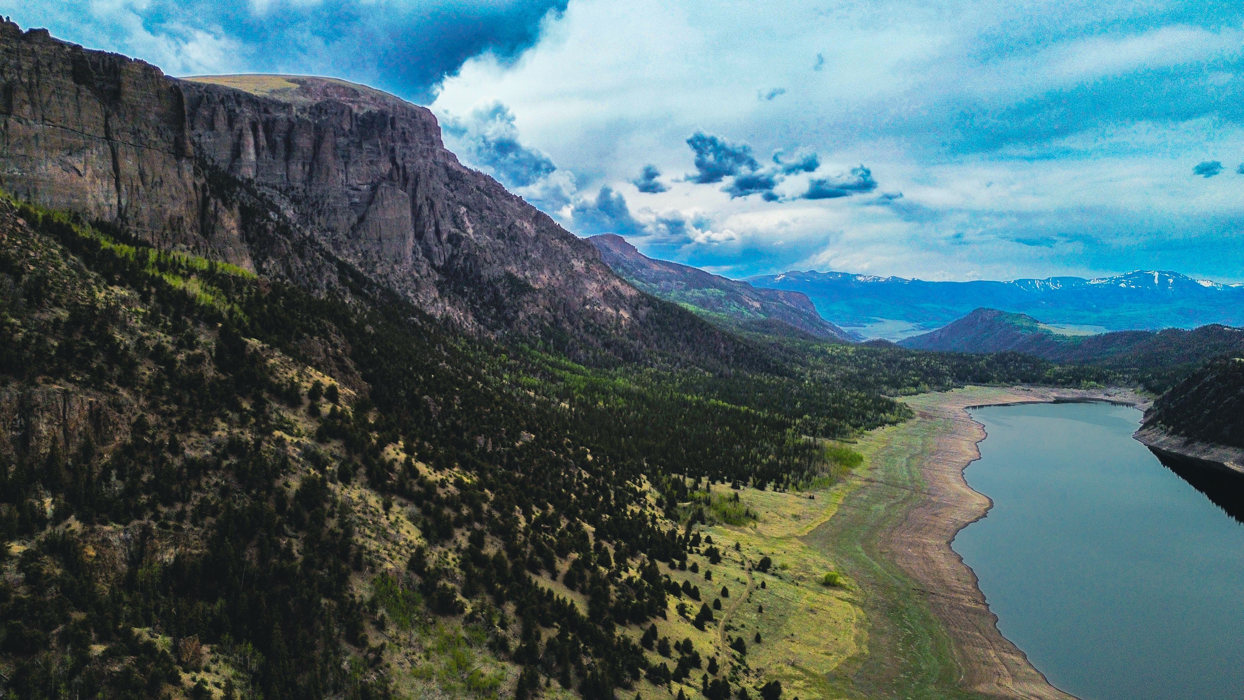
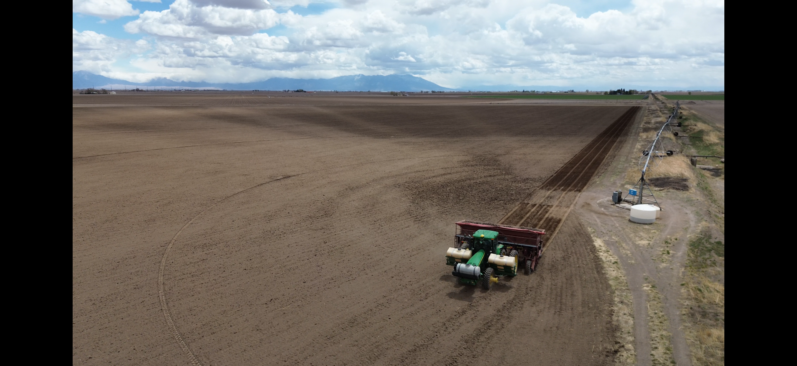
A look at the cliffs, ranches, and farmland we fly. Swapping these out is easy — drop new files in the images folder and update one list in the code.
A rotating reel of recent flights over the valley. It pauses when you hover, and you can step through with the arrows, dots, or a swipe. Choose exactly which photos feature here by editing one short list in the code.
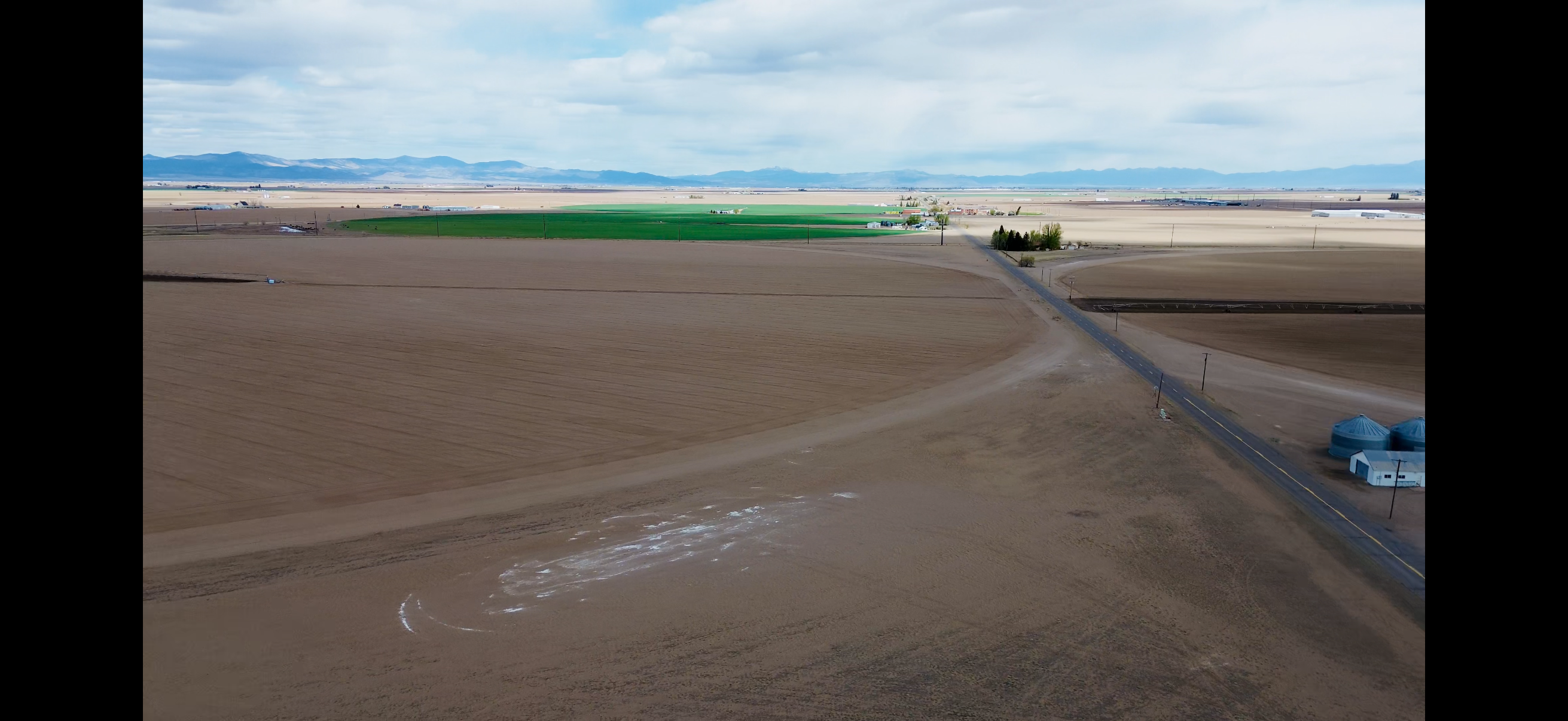
A ground-level photo shows a room. An aerial shows the whole opportunity — the lot, the land, the outbuildings, and how the property sits against the mountains, water, and roads around it. For the wide-open properties of the San Luis Valley, that context is often the thing that makes a buyer reach out.
Listings with aerial imagery simply stand out. They read as professional, they tell a fuller story, and they give serious buyers the spatial understanding they can't get from the curb.
A normal camera captures the same red, green, and blue light your eyes do. A multispectral camera adds bands beyond visible light — especially near-infrared. Healthy plants bounce back a lot of near-infrared; stressed, diseased, or struggling plants reflect noticeably less. That difference is the foundation of crop-health mapping.
Indexes like NDVI turn those readings into a clear map of where a field is thriving and where it isn't — often revealing trouble weeks before it's visible from the cab. For the valley's potato growers, that means seeing problems early enough to act on them.
Three purpose-built drones cover everything from quick listing photos to immersive tours to data-grade crop scans. Specs below are manufacturer figures for each camera.
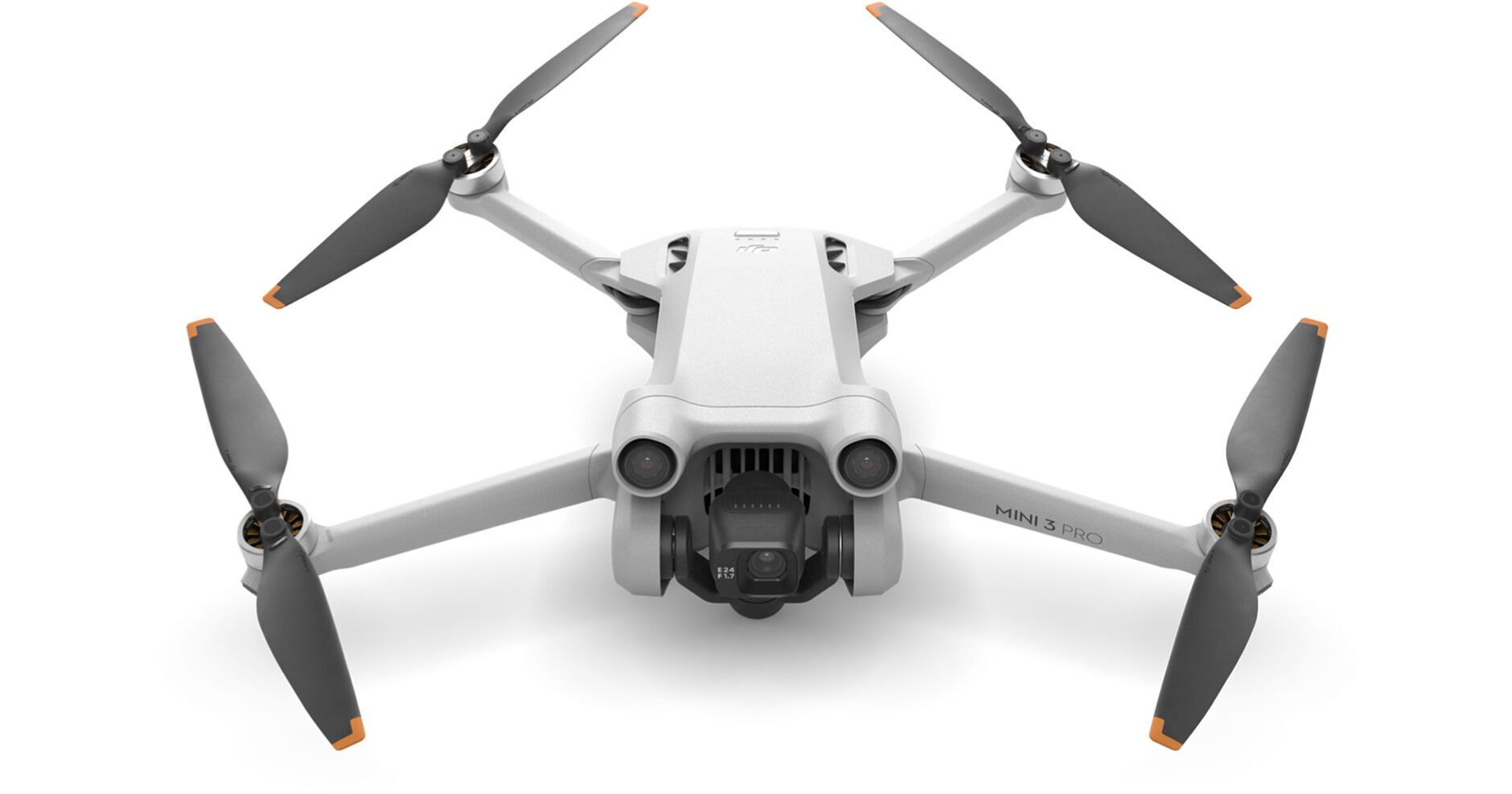
Our go-to for fast, high-quality real estate stills and video. Under 249 g, it gets up quickly and shoots true vertical for web and social.
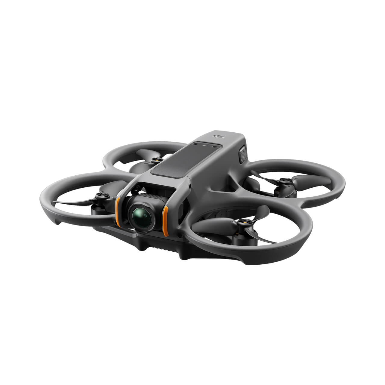
Our first-person-view aircraft for one-take fly-throughs — gliding out a doorway, around a barn, and up over the property in a single cinematic move.
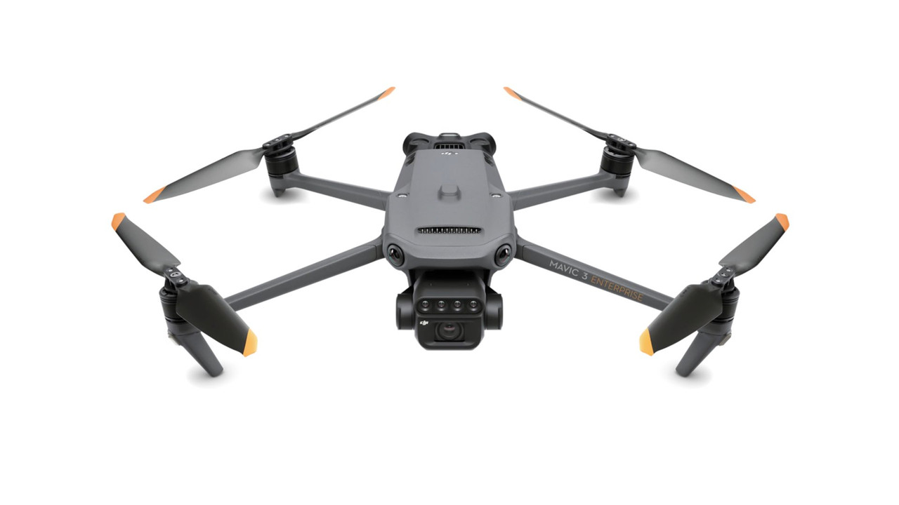
The data engine behind our ag work. It pairs a sharp RGB camera with four single-band multispectral cameras, capturing visible and invisible light in one pass to build crop-health and prescription maps.
How we use it: fly a field once to capture RGB + multispectral data, then process it into NDVI and other vegetation-index maps. Those maps drive stem/stand counts, early disease scouting (including PVY), irrigation checks, and variable-rate prescription maps for fertilizer and spray.
Listing, land, or a field you want mapped in 2027 — send a few details and we'll get back to you with pricing and availability.
FAA Part 107 certified & fully insured · San Luis Valley, CO
Thanks — your quote request is in. We'll get back to you within one business day. Need us sooner? Call or text (719) 480-2867.